From relics to mysterious drawings of aliens: Strange and mysterious places only known to the world since… Google Maps was born
In 2005, Google released Google Maps – a map application based on satellite imagery data. Since then, users all over the world have discovered many interesting places through this application, including truly mysterious locations that the world only came to know thanks to Google Maps.
#1 Mysterious hole formations in Peru
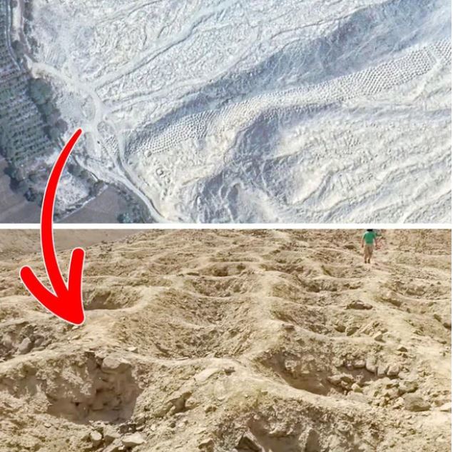
This formation consists of over 6,000 odd-shaped holes with varying sizes, stretching about 1.6km from the Pisco Valley to the Andes mountain range. Viewing this on Google Maps, it can truly give some people goosebumps, especially those with Trypophobia.
This location has been known since 1933, and until now, its existence still remains a mystery. Archaeologists can only hypothesize that it was used for burials or to store something. However, none of these theories have been verified and remain contradictory.
#2 The “pin” island in the Netherlands
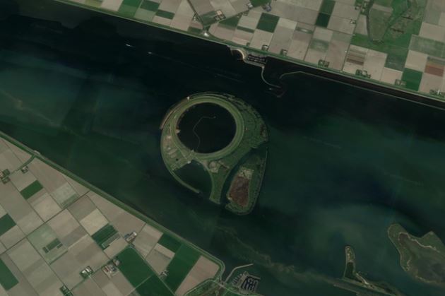
Few people know that the Netherlands has an artificial island located in Ketelmeer. This island, called IJseeloog, has a circumference of only about 1km and was created for storing contaminated sediment.
Viewing this on Google Maps, it looks similar to the pin that marks the location on the application.
#3 The giant triangle in the United States
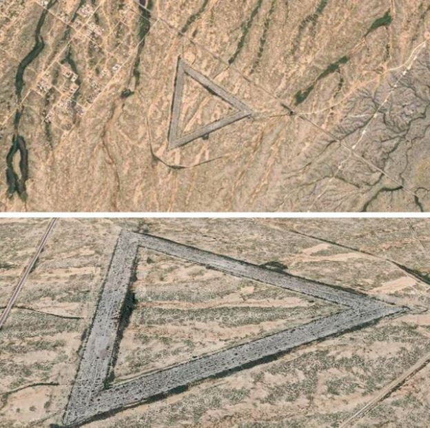
This strange location is in Wittmann, Arizona, and although it looks mysterious, it is actually an abandoned air force base from 1956 to 1966.
#4 The super fingerprint in England
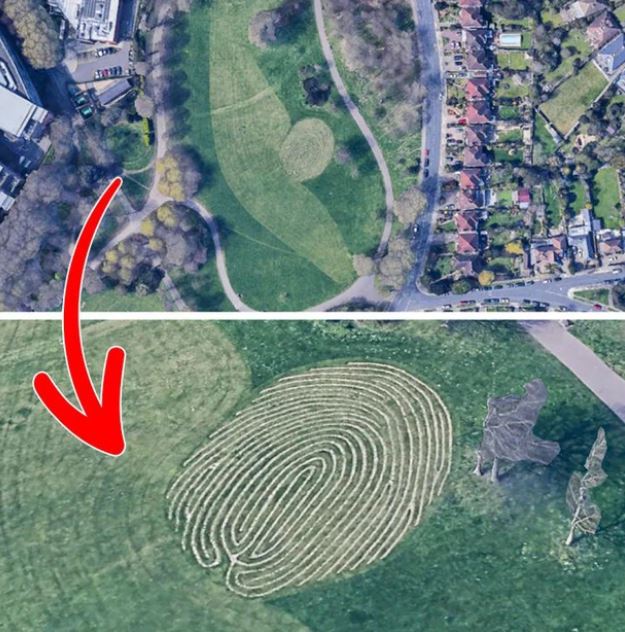
This location, called Fingermaze, is located in Brighton and looks like a giant fingerprint on Google Maps. In reality, it is a sculpture by artist Chris Drury, created in 2006, representing the journey of life.
#5 Mysterious symbols in the Gobi desert in China
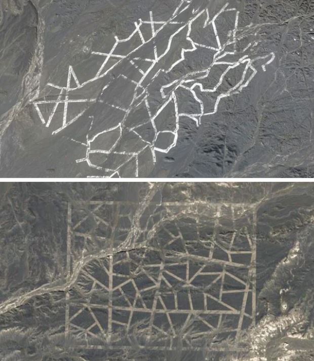
For a long time, strange symbols in the Gobi desert were thought to be the work of extraterrestrials. However, in reality, they were made by humans and used for satellite calibration purposes, according to Jonathan Hill, an expert from the University of Arizona.
#6 The Face at the South Pole:
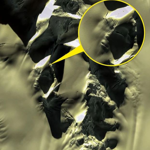
This image was captured by a satellite from Google Maps, at a mountain in the South Pole. When it first appeared, conspiracy theorists claimed it was evidence of extraterrestrial life.
However, there are much more logical theories. In general, this could entirely be a natural phenomenon, created by ice fractures. We see a human face because of the pareidolia effect – it makes our brains see objects in familiar shapes.
“Pareidolia is a psychological phenomenon that makes people see clouds, rocks, and other objects in more familiar shapes,” NASA explains about this phenomenon.
#7 Memorial Monument in the African Desert
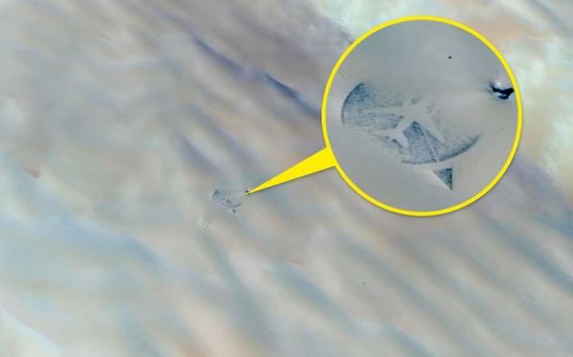
In 1989, an airplane exploded in the Ténéré desert. In 2007, the 18th anniversary of the disaster, a memorial monument was built in the desert, in the shape of the real-life airplane and with 170 broken mirror pieces – symbolizing the number of lives lost.
Thanks to Google Maps, this place has become more known to the world.
#8 The Giant Calibration Target in the US
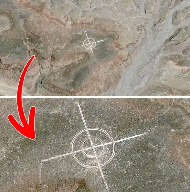
It looks like a joke, but the picture is real. The icon exists to calibrate aerial photography. In reality, there are many similar signs at air bases in the desert.
#9 The Unfortunate Car in the Bahamas
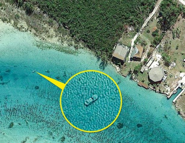
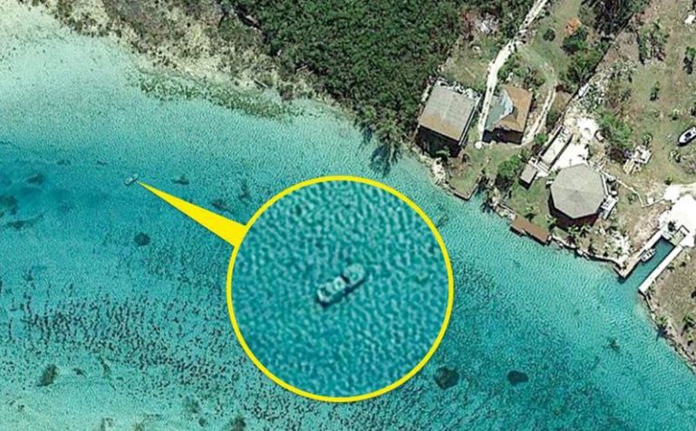
To this day, no one knows the story behind this car, or why it is underwater. But it shows the terrifying accuracy of what Google Maps can do.
